Wednesday, June 16, 2010

Discovering Kemensah Waterfall, Kg Kemensah


Kemensah Waterfall | Waterfall with ray of light


Kemensah Waterfall is my first photography outing that require me to trek a bit before reaching it. And that time i'll never guess that later it would be the most easiest one compared to other remote/high places that i went for my hobby.

The waterfall's name is not Kemensah. We named it as Kemensah as the nearest village is Kampung Kemensah. A local people once told me its real name but i forgot it. I'll update this blog entry later when i found out its real name.


After a mere 45 brisk walking through ATV road, passing through bamboo jungle you will reach the first waterfall. If you hike further up the stream, there is a lot more waterfall to be found. I remember hiking until 6th level (and few fren went for the 7th level).

I already went to this waterfall for three times. At one occasion we manage to catch a very good ray of light at this waterfall. Really miss this waterfall and hope to repeat visiting it with fellow friends.


Kemensah Waterfall | Waterfall with ray of light low angle

Kemensah Waterfall | Water Stream


Some macro photos from this location

Kemensah Waterfall | Spider - ID needed (2:1 FF)

Kemensah Waterfall | Spider - ID needed (2:1 FF)

Kemensah Waterfall | Super tiny weevil (5:1 FF)

Kemensah Waterfall | Tiny spider with a parasit (fly larva?) (5:1 FF then cropped)


How to get here - Kemensah Waterfall

Find your way to Zoo Negara. Follow the road by the Zoo Negara side. After few kilometers you will reach Kampung Kemensah,drive straight. After the village area the road will be a bit windy You will pass the fishing pond (on your left) and a chalet on your left.(Do not turn left at the Kolam Memancing Junction). After few kilometers you will pass another fish pond (on your left) and then you will found an entrance to a construction site on your right. At your left is the starting trail to this waterfall. The trail is also used by the ATV operator so it is wide enough for a small ATV.

Safety Note
Please take note that the place at the start of the trail doesn't seem safe to park your vehicle (since it is deep inside and out of nowhere) but that is your only choice if you want to start track immediately. Alternatively you might park your cark at the Chalet (pay RM2) and then walk for few kilometers to the starting trail.


Share Click to share this article in your Facebook!

Tuesday, June 15, 2010

Swimming with the kelah at Air Terjun Sg Chilling, Kuala Kubu Bharu

Arey @ Chilling Waterfall


Lineup
emran, arey & butet

Kelah (Malaysian Red Mahseer) is one of Malaysia’s precious ecological heritage. This fish is unique to our region. Chilling River is one of the Kelah Sanctuary which is near to the Klang Valley. For an hour of journey from Kuala Lumpur would drive you to the entrance of this sanctuary. No need to go to deeper forest such as the Endau-Rompin National Park to enjoy swimming with this fish.


Don Buttet dengan puluhan kelah 'peliharaannya'
Buttet swimming with the Kelah


Another attraction here is the Chilling Waterfall. The waterfall height is about 60m height which would dwarfed any human being. The journey itself is very rewarding. As we trek along the river, we need to cross the river for a total of six times. The first crossing is via a suspension bridge. But you'll get yourself wet for the other crossing. At some crossing the water height is at your half thigh level so you need to be very careful with your camera equipment (if you bring any). Bringing a small child is possible but you should always be extra careful. You should also always alert for "kepala air" sign as the were cases in the past that some camper were drowned due to this nature phenomenon here. (normal tips is never trek whenever you suspect there is heavy raining at upstream(hulu) of the river, watch the sky).


Chilling Waterfall (IR)
Chilling Waterfall in IR spectrum


How to get here - Chilling River Waterfall, KKB

Drive to Kuala Kubu Bharu town. From there go towards Fraser Hill. You will drive by the dam side. After about 15 minutes, you will pass an old small bridge (folks at KKB called it as 'jambatan kombat') at a corner bend, immediately after this bridge you can park your vehicle on the left side. The entrance to the Sungai Chilling Kelah Sanctuary is on the right clearly stated with a gate. You need to trek for about 10 minutes to reach the Chalet/Office compound. Register there (pay RM1 fee) and you can proceed to the waterfall afterwards. (The ranger office only open at 8:30am - a total letdown for those who wish to arrive early and take slow shutter picture especially during weekend where you want to avoid the crowd to get a good picture)Map board available at the compound if you need to get yourself familiar with the trek first. From here you will need about an hour to reach the waterfall.

Share Click to share this article in your Facebook!

Abseiling at Air Terjun Sungai Pisang, Gombak

Sungai Pisang Waterfall


Sungai Pisang is a beautiful waterfall located not far from Karak Highway. You need to trek from around 20-40 minutes (depend on which path you used) to reach this waterfall. Some outdoor freelance also conduct abseiling / team building program here as the waterfall is very suitable for abseiling activities. There is minimal drown risk here as the pool there is not deep at all. (wonder how someone posted a comment at waterfallofmalaysia about near drown story there). During our trip there is an abseiling activity conducted for a student group from Mahsa College .

Some of the picture taken there


Air Terjun Sungai Pisang

Ray of Light @ Sungai Pisang Waterfall
If you go in early morning , there will be lots of Ray of Light around

Pondok @ Sungai Pisang Waterfall
An old hut along the way


Sungai Pisang Waterfall
One the the smaller fall at the waterfall

Abseiling @ Sungai Pisang Waterfall
Abseiling at Sungai Pisang Waterfall

Abseiling @ Sungai Pisang Waterfall
Facilitator guiding student to abseil down at Sungai Pisang Waterfall


How to get here - Air Terjun Sungai Pisang, Gombak

The easiest way is by the Karak highway. But this method would put your vehicle under risk as it is left by the highway roadside.
After paying the first Karak Highway tol, keep an eye to the kilometer signage by the roadside. Stop at KM 28.7 , from there you can see there is a small trek by the roadside (if you found a small road by the roadside, you missed the signage already). The trek start there. After around 20-25 minutes you will reach the waterfall (you can hear the waterfall gushing sound after 10-15 minutes of trekking).

Second path is by using the old Gombak-Genting road. By this way your car will park within the private area of several chalet operator (safer i guess). Use the old Gombak-Genting road, at KM 11 you will found a junction toward several chalet. Take this junction and go further inside. When you found the chalet parking area, park there. You might need to pay few ringgits for parking there (in our case the operator request RM5/car). From there follow the river upstream until you found a twin tunnel. Walk by this tunnel. It is not recommend to walk inside the tunnels water as they might be unknown creatures such as snake staying there inside the dark tunnel. Use the sideway of the tunnel. (This tunnel is actually a river tunnel underneath the Karak Highway.)

After the tunnel, proceed further a bit until you find a trekking route. This trekking route will bring you to hike a small hill and you will also find few old hut (probabily built by the orang asli). After around 40-45 minutes of trekking you will reach Sungai Pisang Waterfall.

Or alternatively, for a shorter trekking, after passing the tunnel, hike up to the highway road using the drain path. Then go to KM 28.7, and start trekking from the small path not far from KM 28.7 signage. You will trek for around 20-25 minutes only.

Credit to Arey who guide us to this place
Credit to Azri who organize this trip under Luarbiasa Photography umbrella


Share Click to share this article in your Facebook!

Sunday, June 13, 2010

Admiring Air Terjun Robinson, Cameron Highland

One of the waterfall at Cameron Highland. While the waterfall itself is very beautiful, the water quality would disappoint you because drain water is diverted into this river. Trekking would take only around 15 minutes only (downward) from the starting point. The trekking path is fully cemented with tiles, a good featured if its not raining, as when it is raining the tiles trek would be very very slippery.

From the trek path here also it is possible to trek to Gunung Beremban, I'm surely would return to try to trek to some mountain around Cameron Highland.


Robinson Waterfall


How to get here - Robinson Waterfall


The entrance to this waterfall start from Tanah Rata town. Find a junction by the Tanah Rata bus station, just go straight until a bend/turn where there is a small river/drain running underneath. There is a junction to the right. Take the right turn and 50m from the junction you will reach the trekking starting point at your left by the river side. (There is housing around this area).

Share Click to share this article in your Facebook!

Excursion to Gunung Cantik, Cameron Highland,

Gunung Cantik (1802m)  is one of the smaller peak available around Cameron Highland. Less famous than most of its cousin, Gunung Cantik is located within the tea plantation of Boh Plantation between Ringlet & Tanah Rata (not the Sungai Palas plantation). The starting point is immediately behind Boh Tea Factory there.


Gunung Cantik line-up
Emran, Ainun & Moorali

The excursion to Gunung Cantik seem easier than what i predicted (thank god.. heheh) .. the starting point at around 1400m definitely help a lot.. :D ..plus the 'highway' along the tea plantation.. the view along the way (Boh tea plantation) was very breathtaking.... Moorali & ainun (my SIL) join my trip to this mountain..

Credit to john for giving a brief guide on how to reach this peak.

Some pictures taken during this excursion


Strawberry Tea
Strawberry Tea (IR)

Moorali @ Boh Plantation

Harvesting & filtering twig from tea leaves
The tea plantation worker in this picture is Aryadi from Lombok Timur. He's checking the tea leaves he harvested earlier to ensure there is no twig (ranting) inside them.

Hiking Gunung Cantik - Pano
Panorama picture

Along the trail of Gunung Cantik - Pano
As you can see within the picture.. 80% of the trail are this kind of trail... trail used by plantation tractor.. 'highway trail'... very relax..

Young tea leaves
Young Tea Leaves


More picture here

How to get here - Gunung Cantik,Cameron Highland

If you know Boh Tea Factory, the starting point is immediately behind it.

If you coming from Tanah Rata (this would be your starting point if you are using the new Simpang Pulai-Cameron Highland highway) - Just go towards Ringlet. Immediately after the HABU power station,there would a small junction on your left (there are supposed to be a signboard indicating Boh Tea Factory / Boh Estate Teahouse and also Honey Bee Farm. That is the correct junction.

If you coming from Tapah (this would be your starting point if you are using the old Tapah-Cameron Highland road) - Just go towards Tanah Rata after Ringlet. Keep an eye to a small junction on your right. If you reach Habu Power Station then you already missed the junction.


Follow this windy road until you reach the Tea House (beware, the road is small and mostly can only accomodate one vehicle, use you horn to alert coming vehicle). The starting point is immediately behind the factory. The road is actually road used by plantation vehicle.

You will also found a small stream along the way. (Never drink any water as this stream is within a plantation area.. sure lots of toxic pesticides inside the water)

Just follow this path until the end. At the end of this road there would be small path going towards a small secondary forest. That is where the peak is. There is two peak here. One is Cantik peak and another Cantuk/Centuk? peak. I'm not sure which one is Cantik and which one is Centuk/Cantuk?.

There is nothing special about the peak. The breathtaking view along the way up/down is the one that you will treasure.

MNS has a basic Chalet 2KM from the Boh Tea factory and it would be an ideal accomodation if you target to hike Gunung Cantik/Centuk.


Share Click to share this article in your Facebook!

Saturday, June 12, 2010

Immersing Air Terjun Pelangi (Rainbow Waterfall), Sungai Lembing, Kuantan

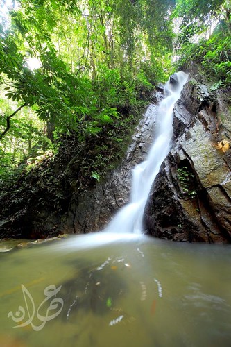
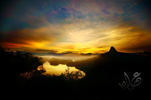
Air Terjun Pelangi (rainbow waterfall) is located near Sungai Lembing Town, Kuantan. Called by the local as Air Terjun 500 (because the fall is estimated at 500f height), it is a very beautiful waterfall with the unique rainbow will always appear around 9-11am every day as the mist produced from the fall would refract the morning light

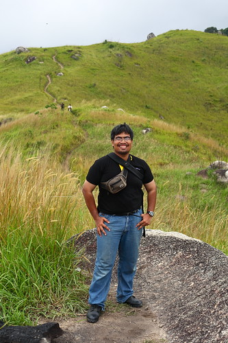
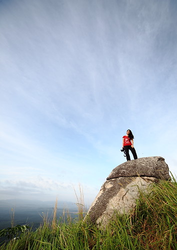
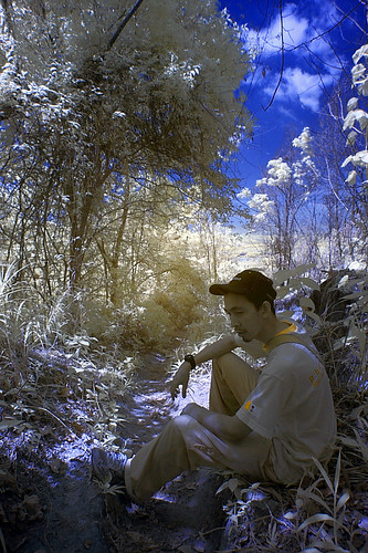
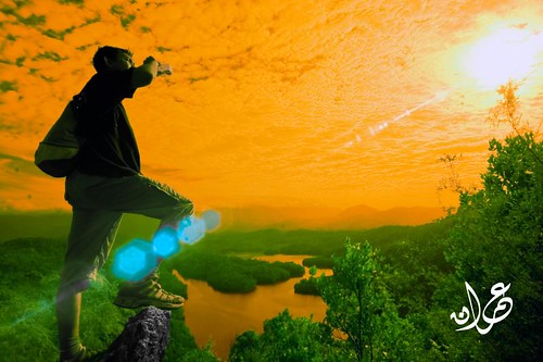
In this trip on 28th Feb 2010, a total of 31 comrades from Luarbiasa Photography group went to camp and hike to Rainbow Waterfall. The outing were combined with a one day Photography Seminar (sponsored by NIKON) at UIAM Kuantan where majority of the comrades also doubled as the facilitator during the practical session.

Roughly our 2D1N itenary is as follows

DAY 1
5:00 pm - IIUM Photoseminar ended. All comrades start preparing for the camping & start moving towards Sungai Lembing Town
6:45 pm - Convoi reached Sungai Lembing town (once famous with tin mining). 4wd & modified hilux (so it can accomodate 12 passenger) already waiting for us. Parked in front of the Sungai Lembing Police Station. The road towards Air Terjun Pelangi is immediately in front of the Police Station.
7:00 PM - convoy (consist of 2 4WD, 1 hilux, 1 storm, 1 pickup lorry & 2 kembara) started the off road journey towards Air Terjun Pelangi camp site.
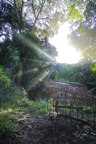
8:20 PM - reached the camp site. Performed the maghrib prayer then setup camp
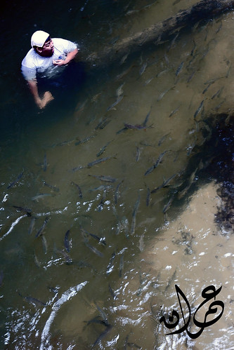
9:00 pm - While waiting for the lamb to be fully roasted, few fellow comrades start to immerse under the river by our camp site. It is indeed refreshing and surprisingly the water is not too cool at all. Some even immerse until 1am before sleeping.
11:00 pm - Dinner time with roasted lamb.
12:00 pm - Majority started to sleep for tomorrow's adventure

DAY 2
5:00 am - a cafe opened by Wanoridz & uDa. Breakfast consist of scrambled egg,lamb roast & australian cheese served.
6:00 am - subuh prayer
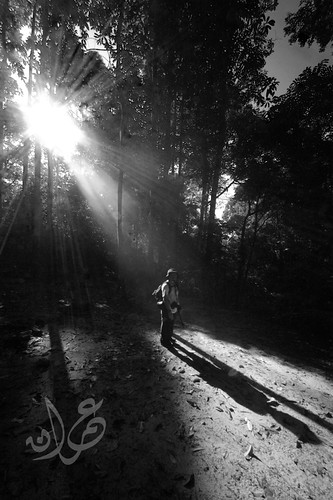
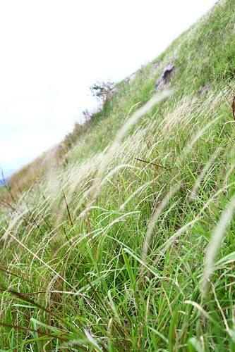
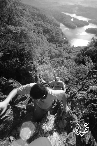
7:30 am - start trekking to Air Terjun Pelangi. The trekking is mild with few hill to climb and we trek along a river most of the time. At first everyone need to pass through a river around thigh level (those with camera bag at waist level need to be very careful at this first river crossing,later were told that normally the water is around waist level but during our visit it was draught season a bit..)
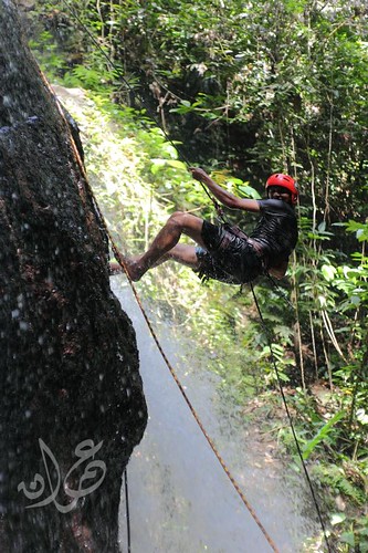
8:30 am - after an hour trekking journey we finally reach the base.. some already starting taking photograph level by level until reaching the raiwbow waterfall. But since it was draught season, the mist produced by the waterfall is so little and only a few rainbow appear for a while during our stay there.

10:30 am - start to trek back to our camping area.
11:30 am - preparing for our journey to go home
12:00 am - start convoying to Sungai Lembing Town
1:15 pm - reached Sungai Lembing Town.
1:30 pm - have a quick lunch at one of the roadside restaurant and after that everyone start their journey to go home after 2D1N adventure.

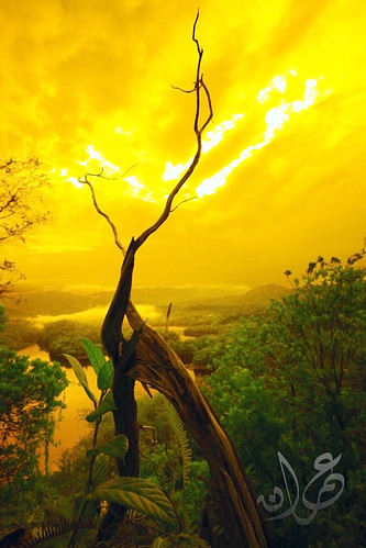
We definitely would repeat Air Terjun Pelangi. I'm hoping to hike Gunung Tapis as well.

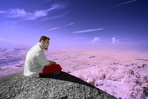
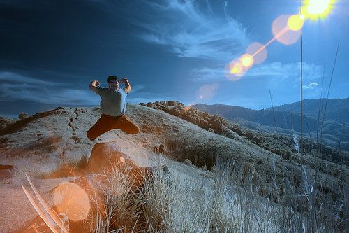
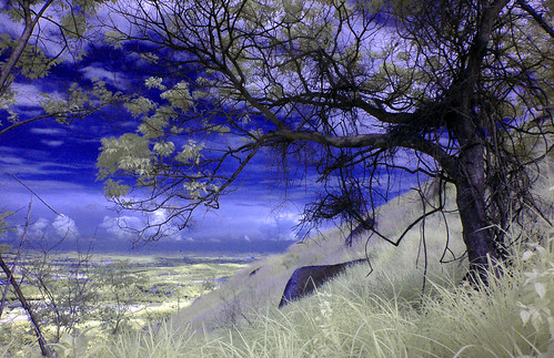
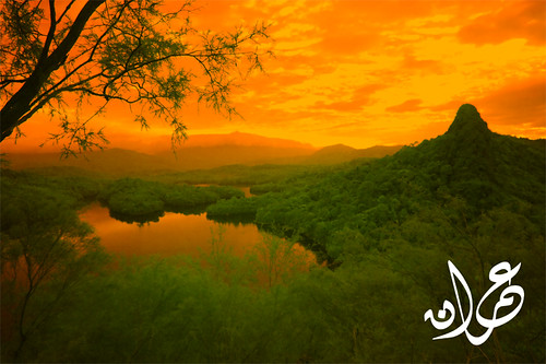
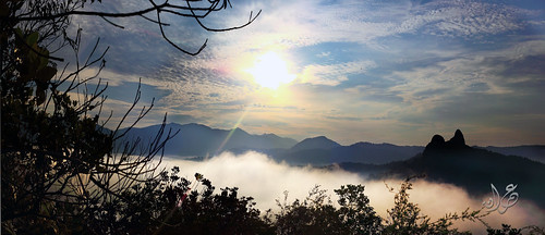
Some of the pictures from Air Terjun Pelangi Trip

Air Terjun Pelangi, Sungai Lembing, Kuantan
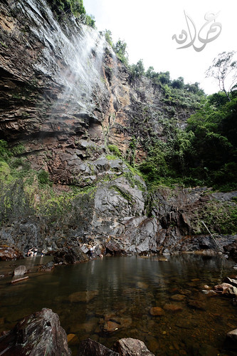
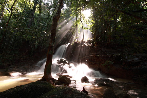
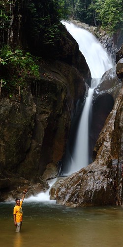
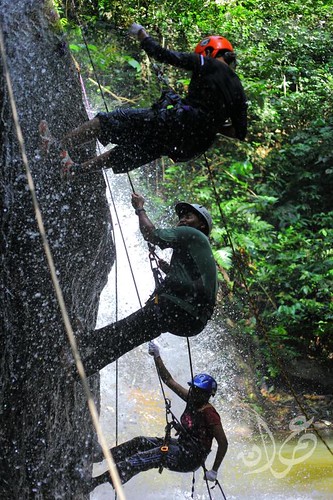
The waterfall (draught season = smaller fall)

IMG_2679
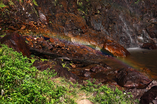
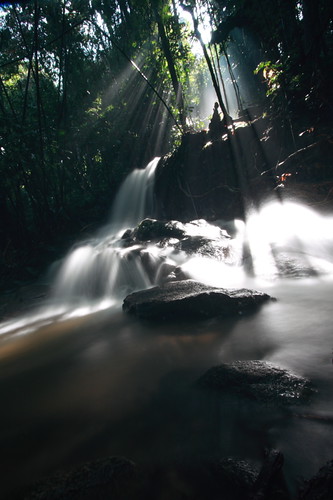
A small consolation rainbow for our trip
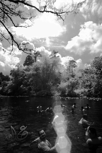
Perhimpunan Teta Luarbiasa
Immersion ceremony

Waterfall
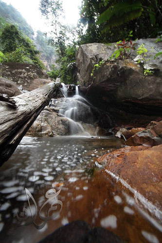
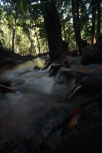
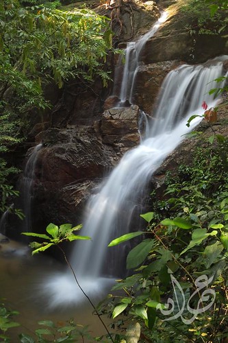
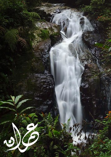
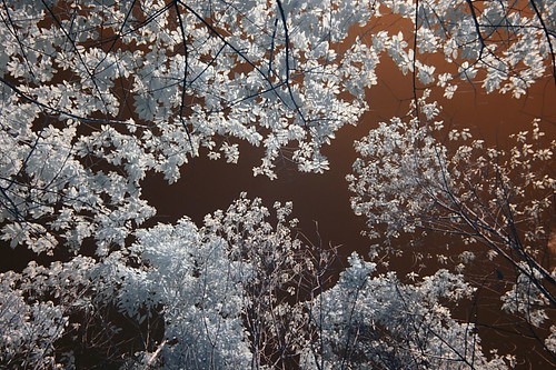
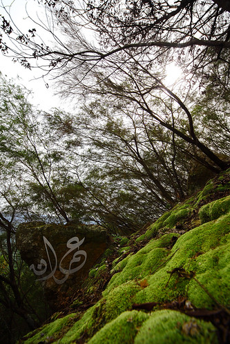
Smaller stream/waterfall along the way


HOW TO GET HERE - Air Terjun Pelangi

If from KL - Use the Karak Highway towards Kuantan direction. Before Kuantan there will be signboard indicating Sungai Lembing exit. Exit there and follow the sign towards Sungai Lembing.

If from Pantai Timur - Just go to Kuantan and from Kuantan there should be ample sign indicating Sungai Lembing direction(if you didnt find any sign go to Indera Mahkota area, west side of Kuantan).

When you reach Sungai Lembing town, find the police station at your left side. The police station should be immediately found at the entrance of the town. Immediately infront of the police station there is a junction. That is the junction toward Air Terjun Pelangi. It is not advisable to go on your own if you never been there as there will be few junction without signboard along the way. Your vehicle must also suitable for offroad drive (from the Sg Lembing town-Air Terjun Pelangi journey) and be prepared for loads of scratches.

After about an hour plus, you will reach an open area by the river. Here is where the first crossing (trekking). You can camp here or at another place further up a bit from here.

Share Click to share this article in your Facebook!

Thursday, June 10, 2010

Broga Hill, Semenyih - Land of Grass

"And the earth We have spread out (like a carpet); set thereon mountains firm and immovable; and produced therein all kinds of things in due balance."
[ Al Hijr verse 19]


Broga Hill is a love hate story for me. The first time i went there is the first hiking trip i join.  During that time, underestimate proved to be bad thing for first timer like me. I remember i bring my whole complete camera equipment up there. The total weight must be about 15kg (two camera body,  4 lenses, 3 flash,1 small umbrella,1 monopod, 1 tripod). While we start climbing in early morning, scores of people keep bypassing me include a group of elderly. What a shame. Hahahahaha.. (i remember swearing i wont repeat this madness again.. hehehehe)

But when you reached the top.. Everything is different... the beautiful land of grass is so majestic and peaceful.. Peak after peak (there is three major peak at Broga Hill),  you would simply admire this place. After the first trip i repeat this place for few times ( i think the total is 4 times). Once i went there during the weekday alone. Very calm and peaceful. But a major lesson learned is never bring your whole equipment on a hiking activity even thought its only a hill like Broga.

Here are some of the picture i'ved taken at Broga. I wish i have the opportunity to repeat hiking in Broga. The only thing stopping me is the distance (45 minutes from KL - Bukit Tabur is nearer!) and the crowd. Some how Broga's fame has grown quite high for the past year and crowd of people would be there every weekend making traffic jam on the single path. Some committee claimed to be representing the community even start charging for car park now (RM2) - which is quite ok for me as now there would be some people guarding around the parking area.

There is one bad memory at Broga, in one of the hiking to Broga led by me, one of our fellow hiker tear both his ligament accidentally. You can read about it here by Faiz Zaki. The incident is even featured in Harian Metro albeit with lots of factual errors. Accident can happen anywhere, even at Broga Hill where the slope & trekking path can be categorized as very safe. You need to exercise caution at all times and never take things lightly.

A friend of mine told that there is another small mountain beside Broga Hill called Gunung Tok Wan which is 3KM from the last peak of Broga. I definitely would repeat broga to visit this small mountain.

Here are some of the picture taken at Broga Hill from my several trips


Broga Hill | Syok sendiri part 5 (#22)
Me @ Broga

Broga Hill | Hill view (#9)
Land of Grass

Broga Hill 25 April 09 | Shikin
Ashikin Abdullah (visit her blog here)

Broga Hill 25 April 09 | SirMart kepancitan (IR)
Sir Mart exhausted after re-hike to bring ice & water for his injured niece (Visit his blog here)

Bukit Broga 25 April | Nature
Nature (IR)

Bukit Broga 18 April | Couple (IR)
Couple @ Broga (IR)

Broga Hill 18 April | Azli (IR)
Azli from top of Broga overseing Bandar Semenyih (IR)

Bukit Broga 18 April | Me (IR)
Me @ Broga (IR)

Broga Hill | The Tree (IR)
Entrance tree to Broga


How to get here - Broga Hill

Assuming you are coming from KL. Find the Kajang-Cheras Expressway. You will need to pay two tolls (as now - 2010 the toll stand at RM1 and RM0.90 ). Just follow the highway until you find Semenyih exit. Exit towards semenyih (left) - see google earth picture below. After few kilometers you will reach Semenyih Town.


From here you should go straight,
- you will bypass a BhP petrol station on your left,
- then a T-junction with traffic light ,go straight - immediately after the junction you can see Semenyih Police station on the your left and Semenyih Mosque on your right
-go straight until you see a petronas on your right, immediately after the petronas there is a T junction with signboard stating left is for Nottingham University & Broga. Take left here. (refer to the google earth picture below)


 - from there you just proceed until you see nottingham university on your left, go further ahead until you reach palm oil plantation (here the road would be reduced from 4 lane into two lane only). Here find an entrance road to the palm oil plantation on your left. If you came during weekend normally there would be other car parked there already.
- park you car there and just follow the trail into the palm oil plantation
- at one point the trail break into a Y junction. The left trail  heading further to somewhere while the right one heading upwards. Take the right one. And just follow the trail onward.
- you will reach your destination in between 30-50 minutes depending on your speed, stamina & how long you need to queue :D

Share Click to share this article in your Facebook!

Monday, June 7, 2010

Save Bukit Tabur West Wing, Gombak - The Longest Quartz Ridge in the World

"And you see the mountains, thinking them rigid, while they will pass as the passing of clouds. [It is] the work of Allah , who perfected all things. Indeed, He is Acquainted with that which you do."
[ An-Naml verse 88]

Bukit Tabur is world-class geological monument located beside Klang Gate Dam, Taman Melawati, Gombak. This is my favourite weekend recreation spot due to its proximity and the moderate challenge that it posed to every hiker that scaled it... Until now I've been there five times where four of it i hike the complete circuit from end to end...

Bukit Tabur is very unique where it you can see from afar especially from MRR2 that it is built from quartz ridge... According to some sources on the net.. they claimed that the Klang Gate Quartz Ridge is the longest in the world.. at about 16km total.

However this great natural gift to our nation is under threat... the planned KL Outer Ring Road (KLORR) will cut through this Klang Gates Quartz Ridge dragon backbone citing this option has the minimum cost compared to other alternative... yeahhh.. rite! (read this article by thestar). Best cost when you failed to acknowledge the invaluable heritage of this place.. I'm deeply saddened with this turn of event.. just five years ago they gazette selangor park where Bukit Tabur is part of it and now they want to destroy it forever..

In this article by the Edge few month ago it cite that the Selangor Goverment is pushing for the inclusion of two sites (one of it Klang Gate Quartz Ridge) in the prestigious United Nations Educational, Scientific and Cultural Organisation (Unesco) World Heritage List. I prayed for this to be a reality.

MNS Selangor has response swiftly to the proposal.. read their comment here, really hope it would be championed by MNS Malaysia as well as we need every helping hand to stop this from happening.

You can also do you part a bit.. sign a petition here .. at least

Here are some of the picture i taken while hiking there...


Tabur Hill during golden hour

Bukit Tabur East from West Wing (IR)

Petualang Bukit Tabur

Misty morning at Tabur Hill, Melawati
Misty morning at Tabur Hill

Arey @ Bukit Tabur West Wing (IR)
Arey @ Bukit Tabur West Wing (IR) (the person who introduced me to this hill)

Rumput Carpet Bukit Tabur
Carpet Grass at the 2nd last hill

Bukit Tabur West Wing (IR)


More picture here


How to Get Here - Tabur Hill (West)


If from Gombak - Use the MRR2 road toward the Ampang direction. You'll be passing Karak Highway entrance (on your left) then Taman Melati (on your right). Go further 1-2km and you'll see Taman Melawati on your left. Take the left turn at the junction under the flyover (see picture) into Taman Melawati.

If from Ampang - Use the MRR2 road toward the Gombak direction. After a petronas station on your left you'll see signboard to Zoo Negara. Stay on the left side of the road and follow the Zoo Negara signboard. The signboard will bring you to the junction under the Taman Melawati flyover. Instead of U-turn to go to the Zoo Negara, take right turn into Taman Melawati.


Not long after entering Taman Melawati you'll see Caltex & BHP petrol on your left and also a school at you right (see picture above). Keep going straight until you found a roundabout. Take 9 o'clock at this roundabout. (see picture below)


After about a kilometer you'll reach another roundabout, take 12 o'clock. Then you'll bump into T-junction. Take right turn and immediately after that another right turn (if you miss the another right turn you'll go to Bukit Mas Apartment). (see picture below)


From here just follow the winding road until the end. You'll find  the entrance to the dam (Puncak Niaga Sdn Bhd). Park anywhere nearby and hike up the starting point not far from the entrance.

From the hiking point, you'll reach the first unblocked sunrise point after about 10 minutes. A better sunrise point is available along the way. The higher the better the view. If you want to do a complete circuit (end to end) you'll need about 3 hours to do it. If you intend to do the full Tabur West circuit, just follow the hiking path to the end. Immediately before the last hill there is a path to the left. This path lead to an orchard. Follow this path until you found an orchard hut. Keep to the left. (There is one case in 2009 where some hiker got lost when they take the right turn and thinking that they are lost they request for help from the authority. A whole group without anyone knowledgable about the place should never hike an unknown area or you'll risk the safety of the whole team)

While you were on this path you should be able to see Bukit Tabur ridge beside you on your left. Sometime you can also hear the other hiker at the hill talking loudly to each other. Just follow the path until you found a kampung house. The exit is very close already. Follow the tarred road downward until you reach the T junction. That is the end. (Your car probabily at the left junction near the dam entrance)


SAFETY NOTE

Tabur is not an ordinary hill. Even though its height is only merely 442m (unconfirmed height) the hiking consist a lot of rock climbing with few steep 70-90 degree slope waiting for you. Few rope will assist at several dangerous point. Any fall could be fatal. Remember the case of two doctor from a private hospital in Ampang. Both of them fall to their death here. If you scared of height (gayat) then this place is certainly not suitable for you.  Read this blog posting of an another incident happen there (east side) witnessed by the blog author.

Just follow the common track and you'll be safe and make sure one of you team member has been here to guide the way.


Share Click to share this article in your Facebook!

Popular Posts (30 days)

Latest post from my other blog