"And you see the mountains, thinking them rigid, while they will pass as the passing of clouds. [It is] the work of Allah , who perfected all things. Indeed, He is Acquainted with that which you do."
[ An-Naml verse 88]
Bukit Tabur is world-class geological monument located beside Klang Gate Dam, Taman Melawati, Gombak. This is my favourite weekend recreation spot due to its proximity and the moderate challenge that it posed to every hiker that scaled it... Until now I've been there five times where four of it i hike the complete circuit from end to end...
Bukit Tabur is very unique where it you can see from afar especially from MRR2 that it is built from quartz ridge... According to some sources on the net.. they claimed that the Klang Gate Quartz Ridge is the longest in the world.. at about 16km total.
However this great natural gift to our nation is under threat... the planned KL Outer Ring Road (KLORR) will cut through this Klang Gates Quartz Ridge dragon backbone citing this option has the minimum cost compared to other alternative... yeahhh.. rite! (read this article by thestar). Best cost when you failed to acknowledge the invaluable heritage of this place.. I'm deeply saddened with this turn of event.. just five years ago they gazette selangor park where Bukit Tabur is part of it and now they want to destroy it forever..
In this article by the Edge few month ago it cite that the Selangor Goverment is pushing for the inclusion of two sites (one of it Klang Gate Quartz Ridge) in the prestigious United Nations Educational, Scientific and Cultural Organisation (Unesco) World Heritage List. I prayed for this to be a reality.
MNS Selangor has response swiftly to the proposal.. read their comment here, really hope it would be championed by MNS Malaysia as well as we need every helping hand to stop this from happening.
You can also do you part a bit.. sign a petition here .. at least
Here are some of the picture i taken while hiking there...
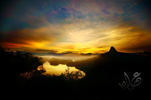
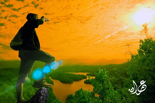
Tabur Hill during golden hour
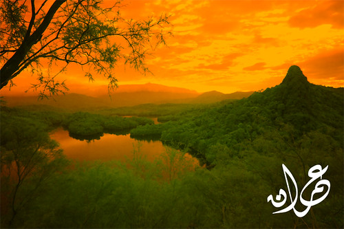
Bukit Tabur East from West Wing (IR)
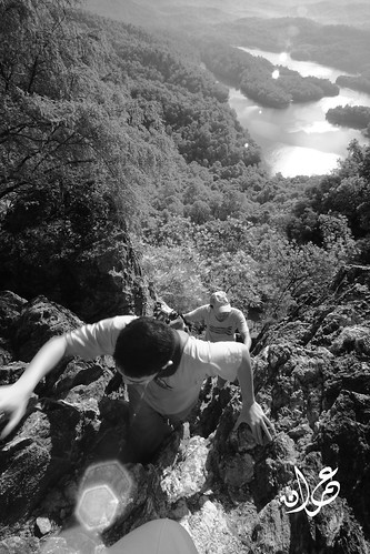
Petualang Bukit Tabur
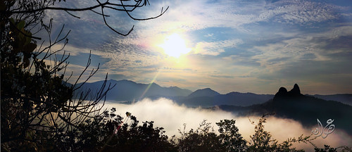
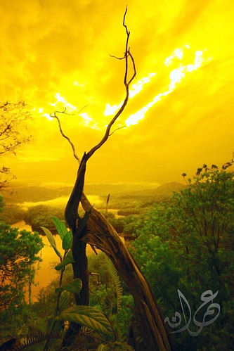
Misty morning at Tabur Hill
Arey @ Bukit Tabur West Wing (IR) (the person who introduced me to this hill)
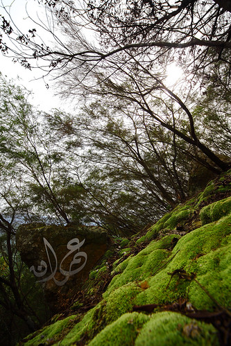
Carpet Grass at the 2nd last hill
More picture here
How to Get Here - Tabur Hill (West)

If from Gombak - Use the MRR2 road toward the Ampang direction. You'll be passing Karak Highway entrance (on your left) then Taman Melati (on your right). Go further 1-2km and you'll see Taman Melawati on your left. Take the left turn at the junction under the flyover (see picture) into Taman Melawati.
If from Ampang - Use the MRR2 road toward the Gombak direction. After a petronas station on your left you'll see signboard to Zoo Negara. Stay on the left side of the road and follow the Zoo Negara signboard. The signboard will bring you to the junction under the Taman Melawati flyover. Instead of U-turn to go to the Zoo Negara, take right turn into Taman Melawati.

Not long after entering Taman Melawati you'll see Caltex & BHP petrol on your left and also a school at you right (see picture above). Keep going straight until you found a roundabout. Take 9 o'clock at this roundabout. (see picture below)

After about a kilometer you'll reach another roundabout, take 12 o'clock. Then you'll bump into T-junction. Take right turn and immediately after that another right turn (if you miss the another right turn you'll go to Bukit Mas Apartment). (see picture below)

From here just follow the winding road until the end. You'll find the entrance to the dam (Puncak Niaga Sdn Bhd). Park anywhere nearby and hike up the starting point not far from the entrance.
From the hiking point, you'll reach the first unblocked sunrise point after about 10 minutes. A better sunrise point is available along the way. The higher the better the view. If you want to do a complete circuit (end to end) you'll need about 3 hours to do it. If you intend to do the full Tabur West circuit, just follow the hiking path to the end. Immediately before the last hill there is a path to the left. This path lead to an orchard. Follow this path until you found an orchard hut. Keep to the left. (There is one case in 2009 where some hiker got lost when they take the right turn and thinking that they are lost they request for help from the authority. A whole group without anyone knowledgable about the place should never hike an unknown area or you'll risk the safety of the whole team)
While you were on this path you should be able to see Bukit Tabur ridge beside you on your left. Sometime you can also hear the other hiker at the hill talking loudly to each other. Just follow the path until you found a kampung house. The exit is very close already. Follow the tarred road downward until you reach the T junction. That is the end. (Your car probabily at the left junction near the dam entrance)
SAFETY NOTE Tabur is not an ordinary hill. Even though its height is only merely 442m (unconfirmed height) the hiking consist a lot of rock climbing with few steep 70-90 degree slope waiting for you. Few rope will assist at several dangerous point. Any fall could be fatal. Remember the case of two doctor from a private hospital in Ampang. Both of them fall to their death here. If you scared of height (gayat) then this place is certainly not suitable for you. Read this blog posting of an another incident happen there (east side) witnessed by the blog author. Just follow the common track and you'll be safe and make sure one of you team member has been here to guide the way. |
Share Click to share this article in your Facebook!


No comments:
Post a Comment